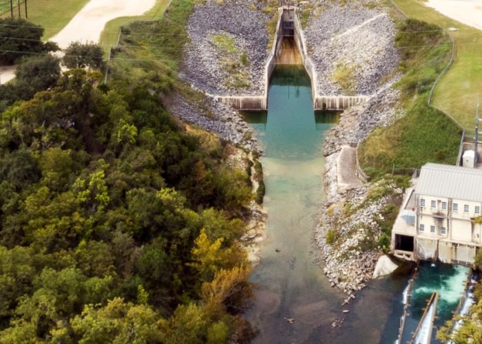
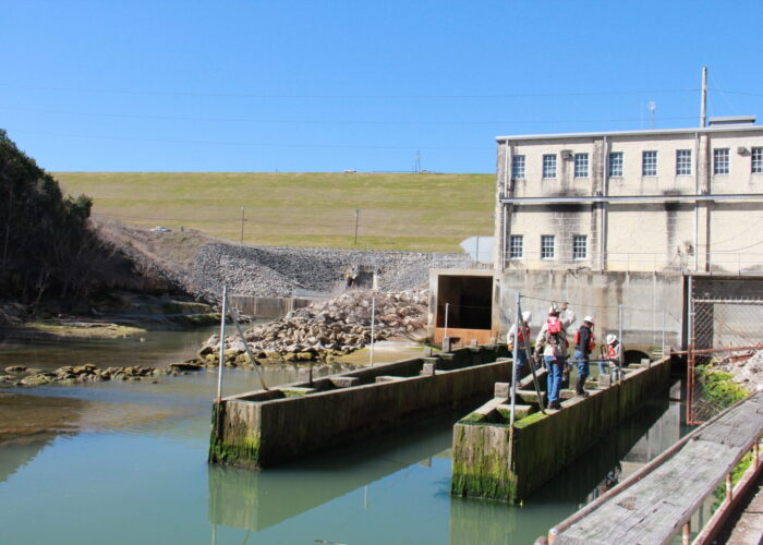
Canyon Reservoir was completed in 1964 and has two main purposes: (1) It provides flood control to an area that is the sixth most flood-prone region in the nation; (2) It provides a dependable supply of stored water for municipal, industrial and agricultural uses throughout the Guadalupe River Basin – especially during droughts and periods of low river flows.
Why was Canyon Reservoir created?
Recreation Resources
The U.S. Army Corps of Engineers (Corps) oversees recreation at Canyon Reservoir. They manage Cranes Mill Park, Potters Creek Park, North Park, and Little Jacobs Creek Park. The Corps leases the Joint Base San Antonio Recreation Area, Canyon Park, and Comal Park. Both Canyon and Comal Parks are managed by Water-Oriented Recreation District of Comal County (WORD). View a map of all the parks around Canyon Reservoir.
Water-Oriented Recreation District of Comal County (WORD) is a great resource for information on Canyon Reservoir releases, river conditions, park information, and other important information.
Source Water Assessment & Protection (SWAP) Program
In 2023, GBRA’s Western Canyon Water Supply system partnered with TCEQ, public water systems who rely on Canyon Lake for drinking water, Water Oriented Recreation District of Comal County (WORD), and the U.S. Army Corps of Engineers to join the SWAP program.
Help us protect the source waters of Canyon Reservoir, and report illegal dumping by calling this hotline number: 830-964-3341.
What is the location and size of the Reservoir?
The Reservoir is created by an earthfill embankment dam located at mile 303.0 on the Guadalupe River. The dam is 224 feet high and 6,830 feet long.
- At Conservation Pool elevation of 909 feet mean sea level (msl), the Reservoir covers approximately 8,200 surface acres and impounds 378,852 acre-feet of water to a depth of 140 feet.
- At maximum Flood Control Pool elevation of 943 feet msl, the Reservoir impounds a total of 732,600 acre-feet of water.
- The Emergency Spillway is at 943 msl.
- Average Annual Net Evaporation is 2.43 feet or 29.2 inches (Texas Water Development Board).
Who owns Canyon Reservoir?
Canyon Reservoir was built and financed through a partnership between the U.S. Army Corps of Engineers and GBRA. The Dam and Reservoir are owned by the federal government – who also owns the rights to the flood control portion of the reservoir (from elevation 909 up to 943 feet mean sea level). GBRA owns the right to the conservation storage portion of the Reservoir (the water stored at elevation 909 feet msl or below). Under its permit with TCEQ, GBRA has the right to store water in the Conservation Pool portion of the Reservoir for water supply purposes and to deliver that water to customers. GBRA pays about 35% of the debt on the Dam and Reservoir, as well as a portion of the annual operating expenses.
How is Canyon Reservoir managed?
The ‘flood control pool’ is managed by the U.S. Army Corps of Engineers. This portion of the reservoir is usually kept empty to contain floodwater from heavy rainfall events upstream of the Reservoir. Releases of floodwater are made by the Corps as soon as possible, but at rates that do not contribute to downstream flooding. Corps regulations designate Gonzales, Cuero and Victoria as ‘control points’ with a maximum rate of 12,000 cubic feet per second (cfs). The Corps must make sure that the Canyon release rate, when combined with local river conditions, does not exceed 12,000 cfs at these locations.
GBRA is responsible for the stored water portion or ‘conservation pool’ of the reservoir. Under permits granted by the Texas Commission on Environmental Quality (TCEQ) and the Federal Energy Regulatory Commission (FERC), GBRA has the right to store water in the ‘conservation pool’ for water supply purposes and to deliver that water to customers. For many, this is their sole water source while others contract with GBRA to ensure a firm backup supply during drought. Releases from the conservation pool are based upon natural inflows, licensed flows for the project, senior water rights, contract releases from the conservation pool for cities, industries and other downstream users, and bay and estuary flow requirements.
How does Canyon Reservoir generate hydropower?
The Canyon Reservoir Hydro plant is a six-megawatt facility located in Sattler, Texas, adjacent to the Canyon Dam discharge channel. It began generating hydropower in January 1989. The plant operates through a license from the Federal Energy Regulatory Commission, with permits from TCEQ and the U.S Army Corps of Engineers. In times of extreme drought, hydropower generation ceases. When it is generating power, it delivers a supplemental energy source to New Braunfels Utilities and City of New Braunfels. The plant has capacity to generate 25,000,000 kWh of electricity annually.
Frequently Asked Questions
What is the total volume of Canyon Reservoir when it is full?
The reservoir, at conservation pool elevation of 909 feet msl, covers approximately 8,200 surface acres and impounds about 378,852 acre-feet of water. An acre-foot of water is about 326,000 gallons.
What are the inflows into Canyon Reservoir?
The mean (average) flow of the Guadalupe River at Spring Branch, upstream of the Reservoir, is about 353 cubic feet per second (cfs). The median flow of the Guadalupe River at Spring Branch is about 150 cfs.
What is the highest recorded inflow to Canyon Reservoir?
On August 3, 1978 the inflow was 160,000 cfs.
What is the lowest recorded Guadalupe River flow into what is now the location of Canyon Reservoir (completed in 1964)?
Inflows of zero cfs were recorded in July 1964, July 2009, August 2009, July through October 2011, and August through September 2013.
What causes Canyon Reservoir's elevation to decline?
Evaporation, and releases for environmental flows and contractual commitments cause the Reservoir to decline. Because of its flood control and water supply functions, Canyon Reservoir was not intended to be a constant-level Reservoir. Upstream floods, evaporation from the Reservoir, demands of downstream senior water rights, and releases for Canyon Reservoir customers all affect its level.
Is the release rate from the Reservoir based on Reservoir level, predicted near-term inflow, predicted long-term inflow, or other parameters?
Downstream senior water rights, the needs of Canyon Reservoir customers and environmental flow requirements are all components used to determine the release rate.
What is the lowest level recorded at Canyon Reservoir? When did this occur?
May 13, 2025 at a level of 877.49 msl.
What is the highest level recorded at Canyon Reservoir? When did this occur?
Since 1964, floodwaters have only overtopped the emergency spillway at elevation 943 msl once — in July 2002.
How is the 'drought of record' for Canyon Reservoir defined? What years did this include?
The historical greatest known drought for the Guadalupe River Basin, which is referred to as “The Drought of the 1950’s” occurred from 1947-1957.
How much Canyon Reservoir water was under supply contract during the drought of record? Was there any problem meeting the demand during the drought of record?
Canyon Reservoir did not exist during the drought of record. It was completed in 1963 and began impounding water in 1964. However, GBRA studies inflows to the Reservoir during the 1950’s drought as part of its yield calculations.


